Key Biscayne and Coconut Grove: The Quiet Side of Miami, By Car
One neighborhood has a dozen ways in. The other has exactly one road — and that changes how you plan the whole day
These two sit next to each other on the map and behave nothing alike.
Coconut Grove is a mainland neighborhood with a dozen ways in and out. Key Biscayne is an island with exactly one. That single difference shapes everything about how you should plan a day that touches either of them — and it is the reason people who know Miami well treat a Key Biscayne dinner reservation more carefully than a South Beach one.
Here is how both actually work from the back of a car.
Coconut Grove: Miami's oldest neighborhood, and its easiest
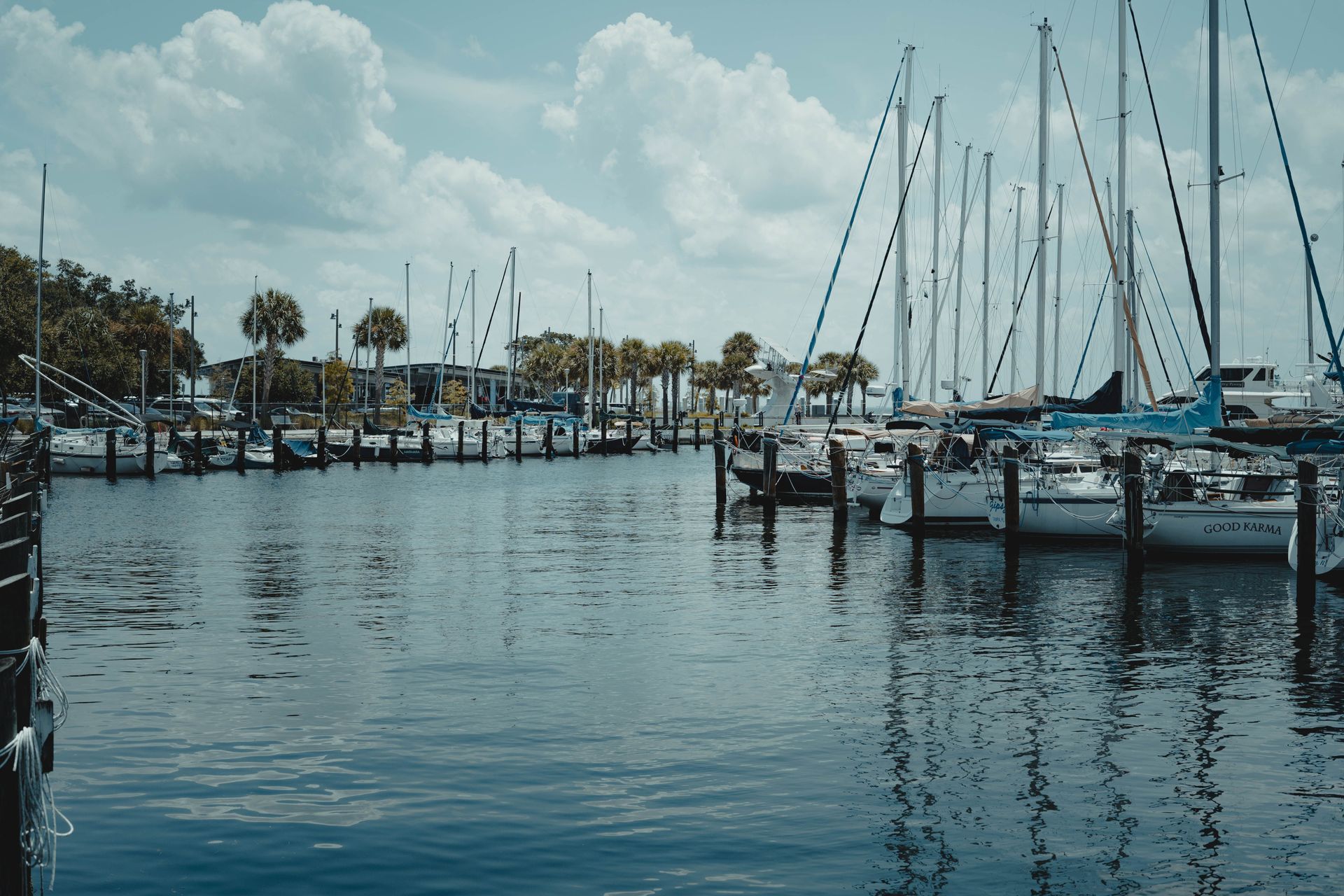
The Grove is the city's oldest neighborhood, with a laid-back, low-rise character that has more in common with a Caribbean port town than with Brickell three miles north. It has been a boating community for well over a century, and it still is — Dinner Key Marina is the largest in Florida.
What makes it easy to visit is unglamorous but useful: it is on the mainland, hard against Biscayne Bay, and reachable from several directions. US-1 runs along its inland edge, South Bayshore Drive traces the water, and Coral Gables is immediately west. If one approach is congested there is another. Nothing about getting into Coconut Grove is fragile.
What is there, broadly:
- Vizcaya Museum and Gardens — the Renaissance-inspired bayfront estate, and the single most photographed thing in the neighborhood.
- CocoWalk — the open-air shopping and dining centre that anchors the village core.
- Dinner Key — the marina, Regatta Park beside it, and the Coconut Grove Sailing Club.
- The Barnacle Historic State Park and The Kampong — a 19th-century bayfront home and a botanical collection, both quiet and both easy to miss.
- Little Bahamas — the historically Bahamian district whose community roots in the Grove date to the 1870s.
- Parks — Peacock Park in the village centre, David T. Kennedy Park along the bay, Alice C. Wainwright Park at the northern edge.
The practical driving note for the Grove is about the last hundred yards rather than the journey. The village core around Grand Avenue, Main Highway and McFarlane Road is narrow, walkable and busy in the evenings, and the streets around CocoWalk are not built for a vehicle to sit waiting. It is a neighborhood where a chauffeur drops you at the corner and repositions rather than idling outside the restaurant — which is exactly how it should work, and why being told "we'll be outside" is less useful here than being told where to walk to.
Key Biscayne: one road, and everything that follows from it
Key Biscayne is a barrier island south-east of the mainland, and Miami-Dade County's own description of the Rickenbacker Causeway is worth quoting exactly: it is "the only ingress and egress connection to the Village of Key Biscayne."
Not the main route. The only one. The same causeway is also the sole land access to Crandon Park and to Bill Baggs Cape Florida State Park at the island's southern tip. There is no second bridge, no alternative approach, and no clever local shortcut. You cross the Rickenbacker or you do not go.
The causeway leaves the mainland near Brickell Avenue, where the toll plaza sits, crosses the high William Powell Bridge, passes Virginia Key, then crosses the Bear Cut Bridge onto Key Biscayne itself. Along the way it takes in the Miami Seaquarium, Virginia Key Beach, Hobie Island and the marinas — which is why the causeway carries weekend beach traffic, cyclists, and island residents on the same three lanes.
What that means in practice
On an ordinary weekday it is a pleasant drive with one of the better skyline views in the city. The problem is what happens when the single road has a bad day.
In April 2024, the Florida Department of Transportation closed the westbound flyover for concrete rehabilitation on a Sunday, pushing traffic onto surface streets to reach US-1 and I-95. CBS News Miami reported one driver who "sat for 9.5 hours on the causeway." Key Biscayne's mayor at the time called the situation "not acceptable," and the northbound flyover was reopened by the following morning.
That is an extreme case, not a typical one. But it is the correct mental model for the island: the downside is not a slower trip, it is an unbounded one, because there is no alternate route to divert to. The county has also been studying the long-term replacement of the Bear Cut Bridge, so periodic works on the corridor are a reasonable thing to expect rather than a surprise.
None of this is a reason to avoid Key Biscayne. It is a reason to plan the exit as deliberately as the arrival.
How we handle Key Biscayne trips
Leave earlier than the map says, in one direction more than the other. Getting onto the island is rarely the issue. Getting off it — to a flight, to a cruise departure, to a dinner reservation on the mainland — is where the single road bites.
Treat it as a block of the day, not a stop you dip into. The same logic that applies to Watson Island during boat show week applies here. Two causeway crossings instead of four is meaningfully less exposure.
Watch the weekend and the weather. Beach traffic to Crandon and Virginia Key peaks on warm weekends, and the causeway is a favourite with cyclists. A Saturday afternoon departure is a different proposition from a Tuesday morning one.
Build a real buffer for airport departures. If you are staying on Key Biscayne and flying out, the leg to Miami International deserves more margin than the distance suggests. This is the single most common way a Key Biscayne stay goes wrong.
There is a toll on the causeway. The county sets and revises the rate, so confirm the current amount with Miami-Dade rather than trusting a figure on a blog — including this one.
One thing a lot of pages still get wrong
If you are searching for the Miami Open expecting to end up on Key Biscayne, check the year of whatever you are reading. The tournament was held at the Tennis Center at Crandon Park for decades, and it moved to Hard Rock Stadium in Miami Gardens in 2019.
That is a completely different journey — north-west of the city rather than south-east, nowhere near the causeway, and with its own traffic pattern. We mention it because outdated pages still send people to the island in March, and because arriving on the wrong side of Miami for a ticketed event is an expensive mistake.
Putting the two together
They pair well precisely because they are different, and a good day often uses both.
The natural shape is Grove first, island second: coffee and a walk around the village core, Vizcaya or the Barnacle in the late morning, lunch on the water at Dinner Key, then across the causeway in the afternoon for Cape Florida, the lighthouse and the beach, with dinner either on the island or back on the mainland depending on how much causeway you want in your evening.
Run it in reverse and you spend the busiest part of the day queueing in both directions. The order matters more here than it does almost anywhere else in the county.
Both areas sit on our Miami neighborhoods page alongside the rest of the city, and a straightforward run between the two — or from a hotel to either — is an ordinary point-to-point transfer.
For a day with several stops and waiting between them, this is textbook hourly as-directed territory — the car stays with you, beach bags and shopping stay in it, and the chauffeur repositions while you are at the lighthouse. Booking two separate one-way transfers for a day like this usually costs you the flexibility that makes it enjoyable.
Common questions
How do you get to Key Biscayne?
Only by the Rickenbacker Causeway, which leaves the mainland near Brickell Avenue. Miami-Dade County describes it as the only ingress and egress connection to the Village of Key Biscayne, and it is also the sole land access to Crandon Park and Bill Baggs Cape Florida State Park. There is no second road onto the island.
Is there a toll to Key Biscayne?
Yes. The toll plaza sits near the causeway's western end at Brickell Avenue. Rates are set by Miami-Dade County and change, so check the county's current schedule rather than relying on a figure quoted elsewhere.
Why does traffic to Key Biscayne get so bad?
Because there is no alternative route. Any closure, works or incident on the causeway has nowhere to divert to. In April 2024 a flyover closure for pavement rehabilitation left one driver stuck for nine and a half hours, as reported by CBS News Miami. That is unusual, but it illustrates why departure timing from the island deserves a real buffer.
Is the Miami Open still on Key Biscayne?
No. It moved from the Tennis Center at Crandon Park to Hard Rock Stadium in Miami Gardens in 2019 — a very different part of the city. Older pages still say otherwise.
What is Coconut Grove known for?
It is Miami's oldest neighborhood, known for a laid-back bohemian character, a long boating tradition, and a bayfront setting. Dinner Key Marina is the largest in Florida, and Vizcaya Museum and Gardens sits at the neighborhood's northern edge.
Can a car wait for us in Coconut Grove?
Not usefully on the village core streets around CocoWalk and Grand Avenue, which are narrow and busy in the evenings. The workable arrangement is a drop at an agreed corner with the chauffeur repositioning nearby, which is how we run it.
Should we visit Coconut Grove or Key Biscayne first?
Grove first, island second, if you are doing both in a day. It keeps your causeway crossings away from the worst of the beach traffic and puts the harder exit at the quieter end of the day.
Sources
- Miami-Dade County, Department of Transportation and Public Works, Rickenbacker Causeway page — the causeway as "the only ingress and egress connection to the Village of Key Biscayne"; sole land access to Crandon Park and Bill Baggs Cape Florida State Park; toll facility near the western terminus at Brickell Avenue; Bear Cut Bridge study
- CBS News Miami, updated 15 April 2024 — westbound flyover closure for concrete pavement rehabilitation, diversion to surface streets, a driver who "sat for 9.5 hours on the causeway," and the Key Biscayne mayor's response
- Miami Open official announcement — relocation from Crandon Park to Hard Rock Stadium in 2019
- Greater Miami Convention & Visitors Bureau, Coconut Grove neighborhood guide — oldest Miami neighborhood, community roots dating to the 1870s, Dinner Key Marina as Florida's largest, and the named parks, landmarks and districts listed above
Toll rates, construction schedules and venue details are set by third parties and change; confirm current information with Miami-Dade County, the Florida Department of Transportation and individual venues before travelling. Traffic observations here are general patterns, not guarantees.
Need a chauffeur in South Florida?
Airport transfers, corporate travel, cruise ports, and events — with flight tracking and chauffeurs who arrive early. Available 24/7 across Miami, Fort Lauderdale, and Palm Beach.